


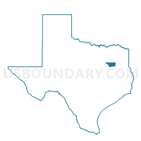
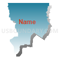
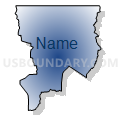
Voting District 003C, Henderson County, Texas
About
Outline

Summary
| Unique Area Identifier | 674601 |
| Name | Voting District 003C |
| County | Henderson County |
| State | Texas |
| Area (square miles) | 49.73 |
| Land Area (square miles) | 44.34 |
| Water Area (square miles) | 5.39 |
| % of Land Area | 89.16 |
| % of Water Area | 10.84 |
| Latitude of the Internal Point | 32.30207720 |
| Longtitude of the Internal Point | -95.51992120 |
Maps


Graphs
Select a template below for downloading or customizing gragh for Voting District 003C, Henderson County, Texas


Neighbors
Neighoring Voting District (by Name) Neighboring Voting District on the Map
- Voting District 0008, Van Zandt County, TX
- Voting District 003B, Henderson County, TX
- Voting District 0042, Smith County, TX
- Voting District 0044, Smith County, TX
- Voting District 03WS, Henderson County, TX
- Voting District 04MS, Henderson County, TX
Top 10 Neighboring County Subdivision (by Population) Neighboring County Subdivision on the Map
- Tyler CCD, Smith County, TX (97,605)
- Bullard CCD, Smith County, TX (29,648)
- Chandler-Brownsboro CCD, Henderson County, TX (11,893)
- Ben Wheeler-Edom CCD, Van Zandt County, TX (7,240)
- LaRue-Poynor CCD, Henderson County, TX (6,906)
Top 10 Neighboring Place (by Population) Neighboring Place on the Map
Top 10 Neighboring Unified School District (by Population) Neighboring Unified School District on the Map
- Tyler Independent School District, TX (118,167)
- Brownsboro Independent School District, TX (15,836)
- Van Independent School District, TX (13,595)
Top 10 Neighboring State Legislative District Lower Chamber (by Population) Neighboring State Legislative District Lower Chamber on the Map
- State House District 4, TX (181,882)
- State House District 6, TX (170,168)
- State House District 2, TX (149,622)
Top 10 Neighboring State Legislative District Upper Chamber (by Population) Neighboring State Legislative District Upper Chamber on the Map
Top 10 Neighboring 111th Congressional District (by Population) Neighboring 111th Congressional District on the Map
Top 10 Neighboring Census Tract (by Population) Neighboring Census Tract on the Map
- Census Tract 9509, Van Zandt County, TX (7,240)
- Census Tract 9514, Henderson County, TX (6,906)
- Census Tract 9501, Henderson County, TX (6,644)
- Census Tract 16.04, Smith County, TX (6,196)
- Census Tract 19.07, Smith County, TX (6,087)
- Census Tract 9502, Henderson County, TX (5,249)
- Census Tract 16.02, Smith County, TX (4,319)
Top 10 Neighboring 5-Digit ZIP Code Tabulation Area (by Population) Neighboring 5-Digit ZIP Code Tabulation Area on the Map
- 75762, TX (12,466)
- 75758, TX (9,072)
- 75704, TX (8,684)
- 75709, TX (5,062)
- 75756, TX (4,002)
- 75770, TX (2,776)